


Tutwiler Fire Dept, Walker County, Alabama
About
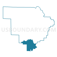
Outline

Summary
| Unique Area Identifier | 523036 |
| Name | Tutwiler Fire Dept |
| County | Walker County |
| State | Alabama |
| Area (square miles) | 54.79 |
| Land Area (square miles) | 51.91 |
| Water Area (square miles) | 2.88 |
| % of Land Area | 94.74 |
| % of Water Area | 5.26 |
| Latitude of the Internal Point | 33.57912830 |
| Longtitude of the Internal Point | -87.28183240 |
Maps


Graphs
Select a template below for downloading or customizing gragh for Tutwiler Fire Dept, Walker County, Alabama


Neighbors
Neighoring Voting District (by Name) Neighboring Voting District on the Map
- Alliance Community Center, Jefferson County, AL
- Copeland Ferry Fire Dept, Walker County, AL
- Liberty Hill Church Voting District, Walker County, AL
- Masonic Lodge West Jefferson, Jefferson County, AL
- Oak Grove First Baptist Church, Jefferson County, AL
- Pleasant Field Baptist Church, Walker County, AL
- Union Hall/Goodsprings Voting District, Walker County, AL
- Windham Springs Baptist Church, Tuscaloosa County, AL
Top 10 Neighboring County Subdivision (by Population) Neighboring County Subdivision on the Map
- North Johns CCD, Jefferson County, AL (4,918)
- West Jefferson CCD, Jefferson County, AL (4,160)
- Parrish CCD, Walker County, AL (3,691)
- Oakman CCD, Walker County, AL (3,557)
- Windham Springs CCD, Tuscaloosa County, AL (3,083)
- Quinton-Wegra CCD, Walker County, AL (1,484)
Top 10 Neighboring Unified School District (by Population) Neighboring Unified School District on the Map
- Jefferson County School District, AL (230,679)
- Tuscaloosa County School District, AL (105,218)
- Walker County School District, AL (52,671)
Top 10 Neighboring State Legislative District Lower Chamber (by Population) Neighboring State Legislative District Lower Chamber on the Map
Top 10 Neighboring State Legislative District Upper Chamber (by Population) Neighboring State Legislative District Upper Chamber on the Map
Top 10 Neighboring 111th Congressional District (by Population) Neighboring 111th Congressional District on the Map
Top 10 Neighboring Census Tract (by Population) Neighboring Census Tract on the Map
- Census Tract 141.02, Jefferson County, AL (4,918)
- Census Tract 122, Jefferson County, AL (4,160)
- Census Tract 214, Walker County, AL (3,691)
- Census Tract 213, Walker County, AL (3,557)
- Census Tract 101.02, Tuscaloosa County, AL (3,083)
- Census Tract 216, Walker County, AL (1,484)
Top 10 Neighboring 5-Digit ZIP Code Tabulation Area (by Population) Neighboring 5-Digit ZIP Code Tabulation Area on the Map
- 35023, AL (25,436)
- 35546, AL (3,901)
- 35580, AL (3,791)
- 35130, AL (3,233)
- 35579, AL (3,136)
- 35006, AL (3,121)